Anoka County has 18 Regional and County Parks. 13 of them have paved and/or natural surface trails, offering many miles of hiking and running opportunities.
A couple of these parks—Bunker Hills and Rice Creek—have several thousand acres. Others are small natural pockets hidden away in neighborhoods and even along highways.
(NOTE: There’s a vehicle fee of $30 annual/$6 per day at all Anoka County Regional Parks. The permit also gets you into Washington County Regional Parks—a great deal!)
Let’s take a brief look at each:
Bunker Hills Regional Park, Coon Rapids
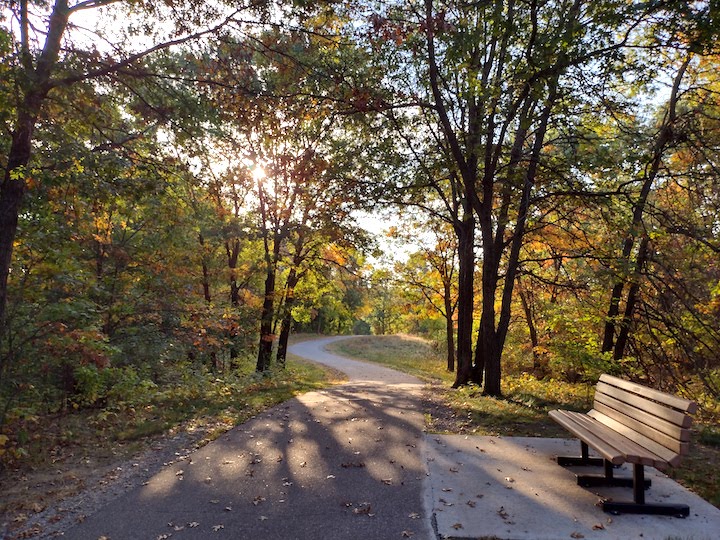
Bunker Hills Regional Park is a wonderful hiking and running destination. Much of the 1,600 acres is wooded, and its many trails go through plenty of twists, turns and hills to keep it interesting.
There are several miles of both multi-use paved trails and natural surface trails for foot traffic only. Click here for the Bunker summer trail map.
Some of the paved trails are plowed for winter hiking during the snowy months. No hiking is allowed on the groomed ski trails. Here’s the Bunker winter map.
Read: Hiking in Bunker Hills Regional Park
Coon Lake County Park, Columbus
Coon Lake Park is mainly known for its swimming beach but does have a couple of short natural surface hiking trails. Here’s the map.
Coon Rapids Dam Regional Park, Coon Rapids
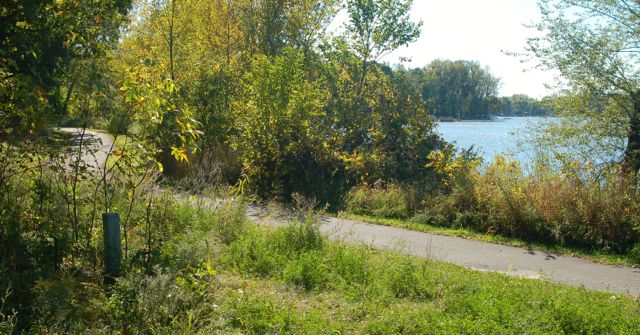
Heavily-used Coon Rapids Dam Regional Park is full of activity year-round. Like Bunker, the hiking trail system interweaves with other local trails, making it very accessible. Its beautiful setting along the Mississippi River makes it popular with boaters and anglers, too.

There are both paved and natural surface trails throughout the 446 acres of the Park. Here’s the summer map.
Most of the trails are groomed for cross country skiing in the winter, but there are a few plowed trails for winter hiking, including across the dam. Here’s the CR Dam winter map.
Read: Hiking in Coon Rapids Dam Regional Park
Islands of Peace County Park, Fridley
Islands of Peace is on a peninsula with a paved trail system jutting out into the Mississippi River. This very short hiking trail system is super scenic, with not just the beautiful river, but huge cottonwood trees throughout the park.
It’s perfect for families with small children and anyone not up for a long hike. There are several spur trails that lead down next to the river, so keep those youngsters in hand! Here’s the Islands of Peace map.
Read: Hiking at Islands of Peace County Park

Kordiak County Park, Columbia Heights
Only 29 acres, Kordiak was the first of Anoka County’s designated parks. Paved hiking trails follow about two-thirds of Highland Lake. If you’d like to do a complete loop, you can move to the streets outside of the Park. Or simply do an out-and-back route. Here’s the Kordiak summer trails map.
Read: Hiking in Kordiak County Park
Lake George Regional Park, Oak Grove
Lake George Park is known mainly for the lake with its large swimming beach. It’s very popular with boaters, too. It isn’t the best hiking destination—it has one paved trail loop. It also accesses the Rum River Regional Trail. Here’s the Lake George summer trails map.
Locke County Park, Fridley
Hidden away between University Avenue and Highway 65 in Fridley, Locke has a nice hiking trail loop along Rice Creek. It takes you on both paved and natural surface trails. This small system connects with the larger Rice Creek West Trail Corridor. Click here for Locke’s summer trails map.

Read: Hiking in Locke County Park
Manomin County Park, Fridley
Tiny 15-acre Manomin is home to Banfill-Locke Center for the Arts. Situated at the confluence of the Mississippi River and Rice Creek, there are both paved and natural surface hiking trails. Not much for distance, but very beautiful! Here’s the Manomin summer trails map.
Manomin’s trails connect with the Mississippi River and Rice Creek West Regional Trails.
Rice Creek Chain of Lakes Park Reserve, Centerville
The largest Park in Anoka County at 5,500 acres, Rice Creek also has some of the best paddling in the Twin Cities. While it offers just a teeny amount of natural surface hiking trails (right around Wargo Nature Center), there’s a network of paved trails throughout the Park that hikers and runners share with bikers. Click here for the Chain of Lakes summer trails map.
A few miles of the paved trails are kept plowed for winter hiking, too. Here’s the Rice Creek winter map.
Read: Hiking at Rice Creek Chain of Lakes Park Reserve
Riverfront Regional Park, Fridley
139-acre Riverfront is south a bit and still along the river. It has a lovely paved trail among mature trees and along the Mighty Mississippi. It connects with trail systems that go into downtown Minneapolis as well as up to Coon Rapids Dam Regional Park. Here’s the Riverfront map.
Rum River Central Regional Park, Ramsey
The Rum River has an amazing number of twists and turns, which makes it perfect for a whole network of hiking trails in 434-acre Rum River Central Park. You’ll share the trails with bikers and may see horses, too. This park has the largest hills in Anoka County’s park system for a more challenging trail run.
This is the first of three Rum River parks, known very much for its paddling on the Rum. Here’s the summer trails map for Rum River Central.
Some of the plowed trails are maintained for winter hiking. Here’s Rum River Central’s winter map. Please stay off the groomed ski trails!

Read: Hiking in Rum River Central Regional Park
Rum River North County Park, St. Francis
For its size (80 acres), Rum River North has a decent amount of mostly-paved hiking trails. It’s known more as the start of the paddling tour down the Rum towards the Mississippi. Click here for Rum North’s summer trails map.
Read: Hiking in Rum River North County Park
Rum River South County Park, Anoka
And finally, the southernmost of the Rum River Parks, Rum River South isn’t an ideal hiking and running destination, but would be a nice stretch after paddling the River! Here’s Rum South’s summer trails map.
See Anoka County Park’s listing of all its parks here.
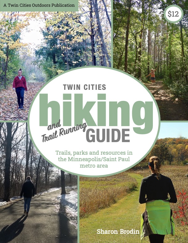
Twin Cities Hiking & Trail Running Guide
Published in 2020 and updated in 2023, our 48-page digital Hiking & Trail Running Guide is the easiest way to find hiking and running trails in all seven counties of the Twin Cities metro area.