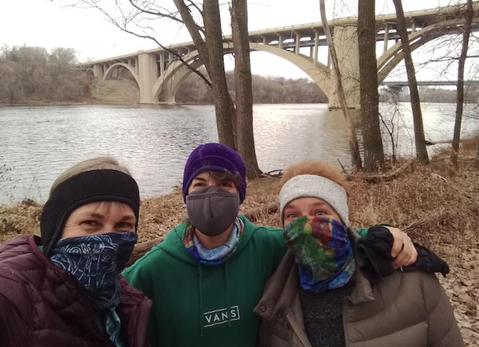
Ramsey County, home of Saint Paul, has a mix of large and small parks with plenty of beautiful hiking trails. Many of them take full advantage of the confluence of the Twin Cities’ two largest rivers, the Minnesota and Mississippi.
One quirk about online info for Ramsey County parks—for some reason there’s no mileage listed for their trails on their maps! Go figure. (Maybe the folks who design the maps and write the site info don’t actually use the trails!)
As we visit the Parks and walk the trails ourselves, we’ll add mileage to this page!
Battle Creek Regional Park (Saint Paul & Maplewood)
Battle Creek Regional Park is 1,840 acres of forest, prairie and wetlands surrounded by urban development. There’s an extensive multi-use paved trail network, as well as unpaved multi-use hiking trails. Here’s the Battle Creek summer map.
There’s plenty of winter hiking open during the snow season, too, both plowed and unmaintained and shared with snowshoers. Here’s the Battle Creek winter map.
Beaver Lake County Park (Saint Paul)
Little Beaver Lake Park offers a 1-mile multi-use trail loop around Beaver Lake. A nice short walk with your little ones or if you only have time for a quickie. Here’s the map. This park isn’t open or maintained during the winter.
Cherokee Regional Park (Saint Paul)
One of Saint Paul’s most popular parks, Cherokee Regional Park is sandwiched between urban development and the Mississippi River. The paved hiking trail follows the Park Road, so not the most natural setting. But better than walking on the streets! Here’s the Cherokee map.
Como Regional Park
Como Regional Park gets hundreds of thousands of visitors every year, and for good reason. This jewel hosts a large variety of family-oriented activities from the Zoo to the concert pavilion, to the Lake to the golf course.
There are 2.3 miles of paved multi-use trails meandering throughout the Park and around the Lake. Walk through the charming Zoo and get even more miles in! This was a favorite destination of our family when our kids were young. Here’s the Como Park map.
Crosby Farm Regional Park (Saint Paul)
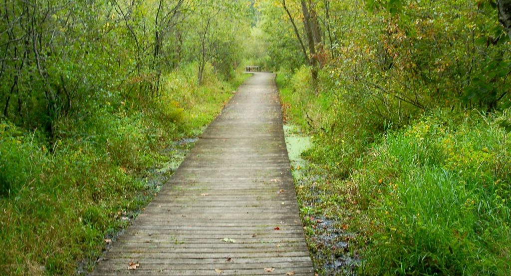
Crosby Farm has one of the longer trail systems in the downtown Saint Paul Park system—almost 7 miles through woods, wetlands and around its two lakes. There are both paved and dirt hiking trails in the park.
As its name suggests, the land was a working farm until the early 1960s, when it was bought and donated to the City for park use. Here’s the Crosby Farm trail map.
Read: Hiking in Crosby Farm Regional Park
Dodge Nature Center (West Saint Paul)
Dodge Nature Center specializes in environmental education for school children. The Main Center’s 8 miles of hiking trails—through forest, wetlands, prairie and along lakes—are open to the public year-round.
Fort Snelling State Park (Saint Paul)
Located in the heart of the city, Fort Snelling State Park has the most natural-surface hiking trails in Ramsey County. There are 18 miles of gravel hiking trails, with another 3 miles on Pike Island. Much of the hiking is along the Minnesota River. Here’s the Fort Snelling summer map.
6 miles of trails are open for multi-use, including winter hiking. Please, no hiking on the groomed ski trails on Pike Island. Here’s the Fort Snelling winter map.
Hidden Falls Regional Park (Saint Paul)
Another of Saint Paul’s regional parks along the Mississippi River. Hidden Falls has almost 7 miles of wooded paved hiking trails, much of it along the Big River. A short dirt trail crisscrosses Hidden Falls Creek a couple of times, too. Here’s the Hidden Falls map.
Winter hiking is encouraged on the 2.5-mile rolled trail, a pilot project in 2021 with added cross country ski trails (not for hiking).
Indian Mounds Regional Park (Saint Paul)
Indian Mounds was set aside to respect Native Americans’ sacred burial grounds. There are a couple of hiking trails in the Park, including the mile-long Indian Mounds Tree Trek. Please respect the Mounds by not climbing up on them! Here’s the map.
Read: Hiking at Indian Mounds Regional Park
Long Lake Regional Park (New Brighton)
Long Lake Park, mostly known for its popular swimming beach, also has over 3 miles of paved multi-use trails. It’s quite hilly here, so you’ll get a good workout. Here’s the map.
These trails are plowed for winter hiking during the snow season. Here’s Long Lake’s winter map.
Maplewood Nature Center (Maplewood)
One of the things the Maplewood Nature Center offers is 1.5 miles of hiking trails through woods and wetlands. While the trails are open year-round, the buildings and facilities aren’t, so check hours during the winter.
Mississippi Gorge Regional Park (Minneapolis)
Even though Mississippi Gorge Regional Park is in Minneapolis, we’re listing it here, too, because you can access it from the Saint Paul side of the River. We couldn’t find a good PDF map of the Park, so it’s hard to tell from the Google Map where it ends to the north! Here’s the Google Map.
Phalen-Keller Regional Park (Saint Paul/Maplewood)
494-acre Phalen Regional Park has 3.2 miles of paved multi-use trails that circle Lake Phalen (incidentally, St. Paul’s only swimming lake!). The Keller segment has a 1-mile paved multi-use trail, too, which will connect you to Phalen for a longer hike or run. Here’s the map for Keller. Here’s the map for Phalen.
Pig’s Eye Regional Park (Saint Paul)
For those curious about the name, the settlement that eventually became the city of Saint Paul was originally called Pig’s Eye! Not a very refined name for a capital city, but it inspires interesting mental images 🙂
When you hike here, bring your binoculars or camera—Pig’s Eye Regional Park is known for its great bird watching, especially herons and egrets. The trails aren’t extensive, but you can certainly go next door to Indian Mounds Regional Park for more, or take part of the Sam Morgan Regional Trail. Here’s the map.
Reservoir Woods Park (Roseville)
This small but very scenic city park has both paved and natural-surface hiking trails, lots of hills and mature woods. It hosts Minnesota’s largest butternut tree as well as stands of huge white pine and cottonwoods. The city provides a topographic map of the park.
Read: Hike Roseville’s Reservoir Woods Park
Rice Creek North Regional Trail (Circle Pines & Lino Lakes)
In the very northwestern corner of Ramsey County is Rice Creek North Regional Trail. One of the few Regional Trails that’s off the roadways, this one meanders along through woods and over prairie with views of Rice Creek and the marshes. Here’s the year-round map.
Read: Winter Hiking: Rice Creek North Regional Trail
Sam Morgan Regional Trail (Saint Paul)
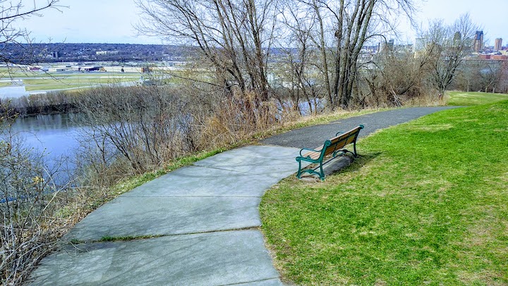
A 9-mile paved multi-use trail that has beautiful views of the Mississippi River and the Saint Paul downtown skyline. Here’s the map (a little hard to read!).
Tamarack Nature Center (White Bear Township)
Truly a natural area, Tamarack Nature Center has natural-surface hiking trails throughout its 320 acres that are for foot traffic only. The trails wind through forest, prairie and wetlands with views of Tamarack and Fish Lakes. Here’s the map.
In the winter most of the trails are designated for cross country skiing and snowshoeing, although winter hiking is allowed on some of the trails. Here’s Tamarack’s winter map.
Read: Hiking in Tamarack Nature Center
Tony Schmidt Regional Park (Arden Hills)
There’s a small network of paved multi-use trails here at Tony Schmidt Park. Here’s the summer trail map. There are winter hiking trails available as well, as you can see on the winter map.
Trout Brook Nature Sanctuary (Saint Paul)
Trout Brook Nature Sanctuary in Saint Paul is a 42-acre pocket with both the paved, multi-use Trout Brook Regional Trail and a crushed limestone “nature trail.” Unfortunately, a railroad track runs along the entire east side of the Sanctuary, but hopefully your hike or run won’t correspond with the train schedule there! Here’s the map.
Vadnais/Snail Lakes/Sucker Lake Regional Park (Shoreview)
There are over 5 miles of lovely multi-use hiking trails here at Vadnais/Snail/Sucker Lakes, mostly paved but some dirt. Its beautiful and varied landscape includes woods, wetlands and open plains. There are plenty of rolling hills, too. Here’s the map.
These trails are open year-round, with some open to winter hiking. Here’s the winter map.
Read: Hiking at Vadnais/Snail Lakes Regional Park
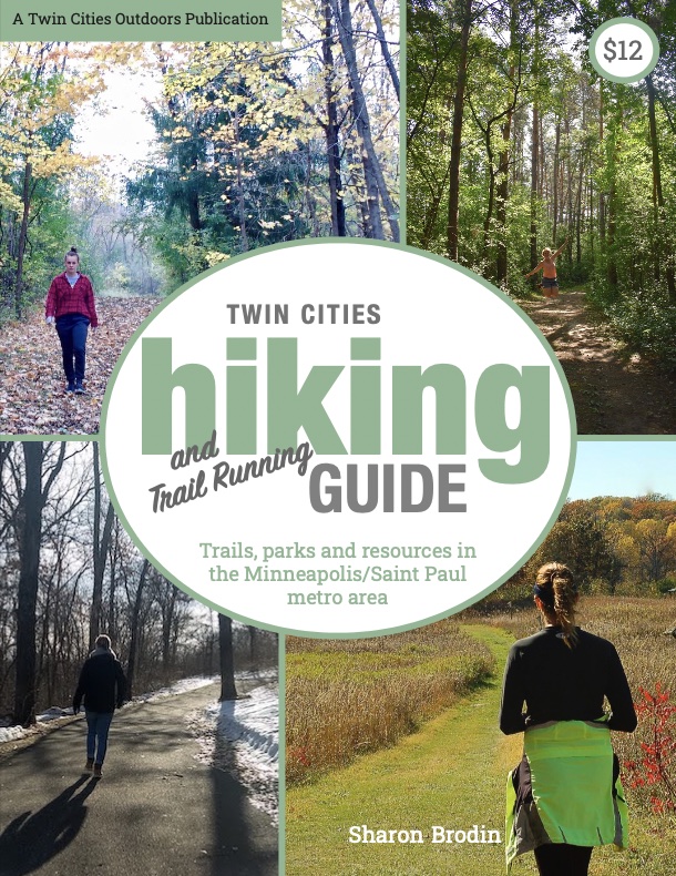
Twin Cities Hiking & Trail Running Guide
Published in 2020 and updated in 2023, our 48-page digital Hiking & Trail Running Guide is the easiest way to find hiking and running trails in all seven counties of the Twin Cities metro area.