Hennepin County is loaded with hiking trails, both paved for multi-use and natural surfaces for more traditional hiking. Whether you prefer an urban or rural atmosphere, there’s plenty of both.

The city of Minneapolis itself has 51 miles of paved trails as part of the decades-old Grand Rounds National Scenic Byway, recognized as a National Scenic Byway.
Here’s a great map of what’s available in the summer throughout the Minneapolis park system. And another map for the winter season. These maps cover all the outdoor recreation activities available, including those not covered here on Twin Cities Outdoors.
The 19 parks below include all of Hennepin County, not just Minneapolis:
Baker Park Reserve (Maple Plain)
19.8 miles of hiking trails wind through 2,700-acre Baker Park Reserve. You can also run or walk the bike and horse trails, giving you the option of more than 20 additional miles. Here’s the Baker Reserve summer map.
There’s a fair bit of winter hiking available at Baker, too. You’ll share most of the trails with snowshoers. For Baker’s winter map, go to Baker’s main park page and scroll down to PDF maps.
Bryant Lake Regional Park (Eden Prairie)
Bryant Lake Park has 4.4 miles of both paved and natural surface hiking trails for foot traffic only, including some hills for a good workout! There’s a section of off-leash dog trails, too, if your dog needs to run off some energy. Here’s the Bryant Lake map.
Crow-Hassan Park Reserve (Hanover)
On the western edge of Hennepin County, Crow-Hassan Park Reserve offers 19 miles of natural surface hiking trails for summer use. 10 of these miles stay open during the winter months. Here’s the Crow-Hassan year-round map.

Read: Hiking in Crow-Hassan Park Reserve
Eagle Lake Regional Park (Plymouth)
230-acre Eagle Lake Park has a 1-mile paved hiking trail that continues on another mile of natural surface. It also connects with other city trails. The paved trail is maintained for winter hiking. Click here and scroll down for the Eagle Lake maps for both summer and winter.
Elm Creek Park Reserve (Maple Grove)
4,900-acre Elm Creek Park is one of the largest parks in the 7-county area. It has 12.7 miles of hiking-only trails and another 40+ miles of multi-use trails also open to foot traffic. Here’s the Elm Creek summer map.
There are several miles of winter hiking trails that are also open to snowshoers, so they’re not plowed. Winter hikers are also welcome in the singletrack park, on the east side of Elm Creek Park Reserve. No hiking on the groomed ski trails, please. Click here and scroll down for Elm Creek’s winter map.
Read: Hiking in Elm Creek Park Reserve
Fish Lake Regional Park (Maple Grove)
There are 3.3 miles of paved and natural-surface hiking trails in Fish Lake Regional Park, including along the edge of a peninsula, giving you great views of Fish Lake. There’s an off-leash dog area on the east-central side of the Park. Here’s the map.
There’s plenty of winter hiking available at Fish Lake, too. Click and scroll down for the Fish Lake winter map.
Read: Hiking in Fish Lake Regional Park
French Regional Park (Plymouth)
On the northeast shore of Medicine Lake, French Regional Park offers almost 10.4 miles of paved and natural-surface hiking trails. The trails hook up with a couple of other regional trails, too. Here’s the French Park map.
Winter hiking is only available on the outskirts of French Park—not on the snowshoe or ski trails. For the winter map, please go to French Park’s main park page and scroll down to PDF maps.
Read: Hiking & Trail Running in French Regional Park

Gale Woods Farm (Minnetrista)
There are 3.5 miles of unpaved hiking trails around Gale Woods Farm, a real working farm. The trails take you through fields, forest, wetlands and along undeveloped lakeshore. Here’s the year-round map.
Hyland Lake Park Reserve (Bloomington)
Hyland Lake Park Reserve features 9 miles of natural-surface hiking trails in addition to almost 9 more miles of combination paved hike and bike trails. Here’s the Hyland map.
There’s a wide variety of winter hiking available as well, including on the snowshoe trails. For Hyland’s winter trail map, click here and scroll down. Be sure to stay off the groomed ski trails, please.
Kingswood Park (Minnetrista)
Brand new to the park system and open to interim use, Kingswood Park currently has 1.4 miles of natural-surface hiking trails. They’re open to foot traffic all year. Here’s the map.
Lake Minnetonka Regional Park (Minnetrista)
4+ miles of paved and unpaved trails are available in Lake Minnetonka Regional Park, part of which are natural-surface hiking trails. Here’s the map.
Just over a mile of the trail system is open for winter hiking, as the rest of it becomes a snowmobile trail when there’s enough snow. Click here and scroll down for Minnetonka’s winter map.
Lake Rebecca Park Reserve (Rockford)
Lake Rebecca Park Reserve has 26 miles of hiking trails, including a couple of large loop trails. There’s also a new single-track trail system for mountain biking, hiking, trail running and snowshoeing. Wetlands, rolling hills, wildlife and wetlands.

In the winter, the entire trail system is open to skiers, snowshoers and winter hikers. These are huge loops, though, so be sure you know your starting and ending points! Click here and scroll down for both summer and winter maps at Lake Rebecca.
Read: Hiking in Lake Rebecca Park Reserve
Minneapolis Chain of Lakes Regional Park (Minneapolis)
Sprawling 1,555-acre Minneapolis Chain of Lakes Regional Park in the heart of Minneapolis includes 7 parks, 5 lakes and 15 miles of lakeside trails. Besides runners, hikers and bikers, the Park also draws multitudes of swimmers and paddlers.
The trails here are crowded, especially in the non-snowy months, after all, it’s in the middle of Minneapolis! But they’re very beautiful, well-maintained, include lots of mature trees and take full advantage of the lakes. They’re open year-round.
The Chain includes the following trails:
- Cedar Lake Regional Trail (3.5 miles)
- Bde Maka Ska/Lake Calhoun (3.1 miles)
- Lake Harriett (2.7 miles)
- Lake of the Isles (2.6 miles)
Minnehaha Regional Park (Minneapolis)
One of the oldest parks in the Twin Cities, Minnehaha Regional Park dates back pre-1900. It’s also one of the most-visited with 850,000 visitors a year enjoying the 167 acres and iconic Minnehaha Falls. The 2.2-mile hiking trail from the Falls takes you along Minnehaha Creek to its confluence with the Mississippi River. Here’s the map.

Mississippi Gateway Regional Park (Brooklyn Center)
This is the new name of what was Coon Rapids Dam Regional Park West. It was confusing with Anoka County’s park of the same name on the east side of the river!
Mississippi Gateway Regional Park has 2 miles of wooded hiking trails, much of it along the Mississippi River. You can also walk across the dam to the Anoka County side, giving you an additional 3-4 miles of possible trails. Here’s the map. The trails are open year-round.
Read: Hiking in Mississippi Gateway Regional Park

Mississippi Gorge Regional Park (Minneapolis)
Mississippi Gorge Regional Park follows the west bank of the Big River for a few miles, with multi-use hiking trails leading to Minnehaha Regional Park to the south. We couldn’t find a good PDF map of the Park, so it’s hard to tell from the Google Map where it ends to the north! Here’s the Google Map.
Mississippi Gorge appears to be part of the next park, which is federal…
Read: Hike the Winchell Trail • Mississippi Gorge Regional Park
Mississippi National River & Recreation Area (Minneapolis)
There are several short and easy paved walks in the Mississippi National River & Recreation Area, which we won’t list but you can find them here. The National Park Service lists 3 hikes in this Area, too. Two of them are Scientific & Natural Areas—Grey Cloud Dunes and Pine Bend Bluffs.
The third is Winchell Trail, an out-and-back starting from 44th Street and West River Parkway, 5 miles up and back. Be aware this trail will be muddy after rainfall. You’ll have great views of the Mississippi Gorge in the heart of Minneapolis.
Nokomis-Hiawatha Regional Park (Minneapolis)
Nokomis-Hiawatha Regional Park is a 650-acre urban park that surrounds Lakes Nokomis and Hiawatha. This lovely area bustles with outdoor activity all year long. A paved multi-use trail encircles Lake Nokomis for a 3-mile hike or run.

You can follow the trail up to Lake Hiawatha as well as catch the trails along Minnehaha Creek. (There’s no online trail map)
North Mississippi Regional Park (Brooklyn Center)
A 1.6-mile paved multi-use hiking trail in North Mississippi Regional Park follows the Mississippi River. It’s not much for peace and quiet since Interstate 94 runs right alongside the Park, but it does offer great views of the river and wooded shoreline. Here’s the year-round map.
Silverwood Park (St. Anthony)
Silverwood has 1.6 miles of paved multi-use trails, including a mile trail that circles the park. Much of the trail follows the shoreline of Silver Lake. Here’s the year-round map.
Read: A Spring Hike in Silverwood Park

Sochacki Park (Robbinsdale)
Little 37-acre Sochacki Park currently has a 1.3-mile hiking trail that is part natural surface and part paved. It’ll eventually connect with other regional trails. Here’s the year-round map.
Theodore Wirth Regional Park (Minneapolis)
While Theodore Wirth is large (740 acres) it has very little for hiking and running—only 1.35 miles. Most of the park is made up of two golf courses and Worth Lake and several gardens. On the other hand, it’s awesome for cross country skiing! So check into that if you’re a skier (click here and scroll down to the info for Theodore Wirth). (Couldn’t find a summer trails map, sorry!)
Wood Lake Nature Center (Richfield)
150-acre Wood Lake Nature Center offers 2+ miles of paved, gravel and (floating) boardwalk hiking trails. The trails meander through marsh, woodlands and prairie. It’s great for bird watching!
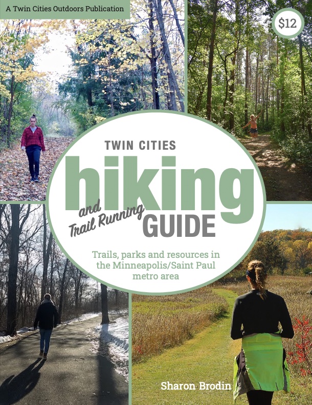
Twin Cities Hiking & Trail Running Guide
Published in 2020 and updated in 2023, our 48-page digital Hiking & Trail Running Guide is the easiest way to find hiking and running trails in all seven counties of the Twin Cities metro area.