There are 35 official state water trails in Minnesota. Six of them flow through the Minneapolis/Saint Paul metro area, all open to kayakers, canoeists and paddle boarders.
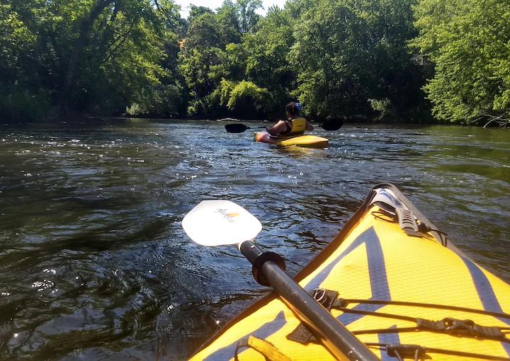
The Twin Cities hosts hundreds of options for paddle enthusiasts, including three major rivers and several smaller rivers and creeks.
State Water Trails are waterways designated by Minnesota’s DNR (Department of Natural Resources). Detailed maps are available with mileage, entry points, exit points, parking areas and more. You’ll see links along with each water trail below.
A couple of important paddling notes:
- Remember, if your canoe, kayak or paddle board is over 10 feet long, it needs to be registered! That’s includes inflatables. Tabs are good for three years.
- Check up on water levels and flow before you head out—especially in the spring or after heavy rains! Don’t paddle above your comfort and skill level.
- While paddling is, in general, very safe, it’s never 100% risk-free, especially on rivers. Where there’s current, there’s risk. Keep your life jacket on and be aware of fallen trees, rocks and other potential hazards.
Cannon River State Water Trail (Dakota County)
The Cannon River State Water Trail flows through a 14ish-mile section of southern Dakota County. This includes Lake Byllesby and its rather rough-and-tumble portage around the dam! You may want to consider the eastern section instead, or start below the dam and paddle east.
The Cannon is a designated Wild and Scenic River and is extremely popular with paddlers, especially in the Cannon Falls area.
Read more about the Cannon River State Water Trail…
Crow River State Water Trail (Hennepin County)
The North Fork and the South Fork of the Crow River meet just northeast of Lake Rebecca Park Reserve. The combined Crow River then flows another 16 miles, forming the northeast border of Hennepin County, to join the Mississippi River.
This designated Wild and Scenic River will take you through woods and rolling farmland. There are access points in both Lake Rebecca Park Reserve and Crow-Hassan Park Reserve, so a day trip between the two is always a good choice.
Read more about the Crow River State Water Trail, North Fork…

Minnesota River State Water Trail (Scott, Carver, Dakota, Hennepin and Ramsey Counties)
The Minnesota River forms the borders of five of the seven Twin Cities Counties in its last 66 miles before converging with the Mississippi River at Fort Snelling.
Although this stretch is more urban than the rest of it, much of it is surrounded by the Minnesota Valley State Recreation Area. So depending on the segment you choose to paddle, you could enjoy a wide variety of scenery from very natural to very urban.
A fun day trip would be to put in near the west end of Black Dog Lake and paddle the 10 miles to Fort Snelling State Park. There are many miles of hiking there, including beautiful Pike Island.
Read more about the Minnesota River State Water Trail segment that runs through the metro area (Segment 6)…
Mississippi River State Water Trail (Anoka, Hennepin, Ramsey, Dakota and Washington Counties)
The Mississippi River also forms the borders of many of the Twin Cities counties. There are many launch options along the way on both sides of the river for either an out-and-back trip or from one launch to another.
Some of the segments are very rural, others very urban. There are a couple of canoe campsites along the river in Anoka County, up in the northwest corner of the Cities if you’d like to try your hand at that!
About 70 miles of the river runs through the metro area. The sections prior to and through the Twin Cities are easy to navigate. But then once it’s past Saint Paul, the river starts to form a lot of channels and lakes that will make navigation trickier.
Read more and get a map for the Mississippi State Water Trail segment that runs through in the Twin Cities (Segment 10)…
Read: Kayaking the Mississippi in Anoka County
Rum River State Water Trail (Anoka County)
The Rum River flows from Mille Lacs Lake 145 miles south to join the Mississippi River in downtown Anoka. The entire river is a designated Wild and Scenic River.
The Anoka County segment starts at Rum River North County Park and flows down to meet the Mississippi and Rum River South County Park. There are several options for launch and mileage, and also canoe campsites along the way if you’d like to try a multi-day trip.
Most of the riverway in this metro section has natural shoreline with a few homes scattered alongside. Once you head towards downtown Anoka it’s much more urban and you’ll need to portage around the small dam in town.
Read more and get a map for Rum River State Water Trail…
Read: Paddling the Rum: Rum River North to Rum River Central
St. Croix River State Water Trail (Washington County)
The St. Croix River flows 169 miles from its source in Wisconsin to its confluence with the Mississippi River. There’s an especially gorgeous 15-mile stretch between Interstate State Park (by Taylors Falls) and William O’Brien State Park.
There are woods, high bluffs, and backwaters to explore. You’ll find the tallest and most dramatic cliffs by paddling upstream from the boat launch in Interstate State Park. Then there are some smaller but equally as beautiful ones a couple miles downstream.
There are also several campsites along the river for paddlers who want the adventure of a multi-day trip.
Read more about the Washington County segments of the St. Croix State Water Trail…
Read: Kayaking the St. Croix River

Which of our local state water trails is next on your to-do list?
For details on rules, outfitters and water levels go to the Minnesota DNR’s Water Trails resource page.
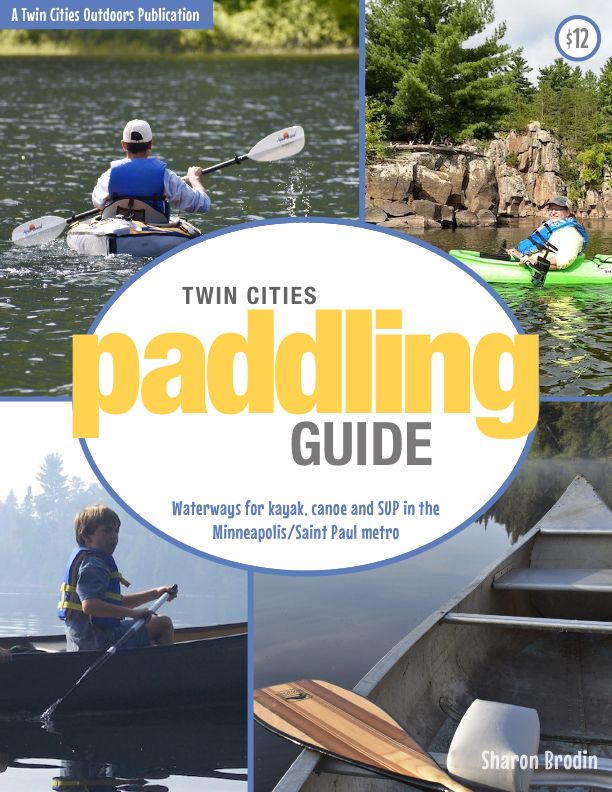
Twin Cities Paddling Guide
Published in 2020, our 52-page digital Paddling Guide is the easiest way to find local lakes and river trails in all seven counties of the Twin Cities metro area.