Roadside Park to Mississippi Point Park • Anoka & Hennepin Counties
We have the 4th longest river in the world right in our backyard. The Mississippi River forms the borders of five of the seven Twin Cities metro counties, and it’s all part of the Mississippi River State Water Trail.
I’ve lived in Minnesota since 1978. And while I’ve paddled countless lakes in the Boundary Waters and a few lakes here near the Cities, I kayaked the Mississippi for the first time just a couple weeks ago. It’s about time!
8-mile Section from Roadside Park to Mississippi Point Park
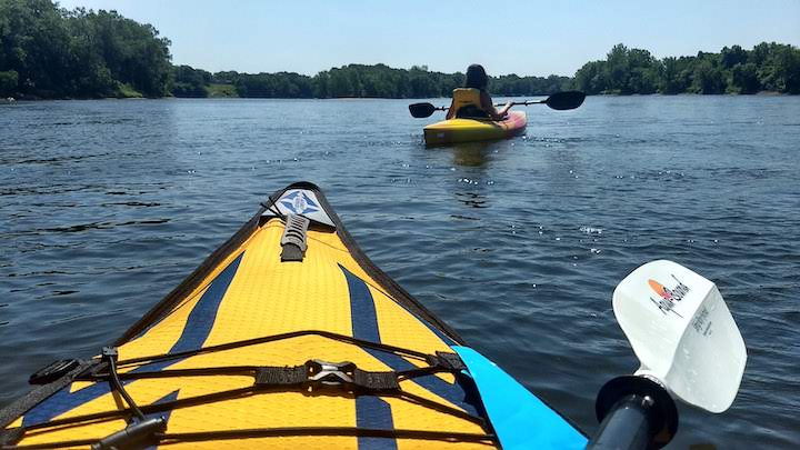
Our son’s girlfriend, Shelby, and I kayaked this portion on a 90-degree day in mid-June with 25 mph winds coming up from the south. That didn’t matter too much to us on the river except for a couple of spots. More on that later.
We met at Mississippi Point Park in Champlin where Shelby left her truck. This is a popular boat launch for the river in this area—which means if you do this trip on a weekend, get there early to get a parking spot! We went mid-week so no problem.
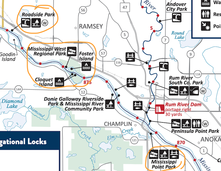
We drove together back across the Ferry Street Bridge into Anoka and north on Highway 10 to Roadside Park. Here’s the section of the map we paddled:
This park is actually a very nice wayside rest. It doesn’t look like much coming off the highway, but the road goes past the restroom building and circles around next to the river. There are several parking areas, picnic table areas and mature trees for shade.
Launching from Roadside Park
The canoe launch here is marked on the map but there’s no sign in the park itself! Using common sense, we figured we’d be able to access it from the parking lot closest to the river, which, indeed, was the case.
We saw a dirt trail through the trees in the direction of the river, and walked it first so we knew what to expect. It’s short, narrow and a titch downhill with easy access to the water. There are lots of small boulders and rocks along the shore, but it’s shallow and easy to get in the kayaks.

If you were to launch further upstream and plan to exit here, it’d be a challenge to find from the water! You’re probably better off planning to exit at Mississippi West Regional Park, which is much more obvious—and marked by signage. It’s 3 miles further downstream.
Canoe Campsites on the Islands
Besides the boat launch at Mississippi West Regional Park, there are three canoe campsites on the two islands in the river (circled in the map above). One is on Foster Island and two on Cloquet Island.
We didn’t stop to check them out this time, but this would be a great spot to try canoeing camping if you’ve never done it.
There’s no charge to use these sites, and they’re first-come, first-served. If you’ll leave your vehicle in the Park there overnight, though, you’ll need a special use permit from Anoka County. More details here.
Scenery and Water Conditions
The first half-to-2/3rds of this section is mostly wooded along both shores, with private property scattered here and there. We saw a bald eagle a couple times, and a doe drinking along the shore in one spot, and, of course, quite a few water birds.
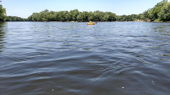
Like I mentioned earlier, there were 25mph winds that day, coming up from the south. Since we were kayaking with the current they didn’t really mean much except for a couple odd sections.
In one spot, the river turned full-on into the wind and we had big waves coming at us—yet the current was carrying us into them so paddling was easy! It was the oddest thing. I’ve done a lot of paddling in high winds and it’s usually no fun at all. Having the wind and current going opposite directions was new for me.
The closer we got to the more urban areas of Champlin and Anoka, the more homes we saw along both shores.
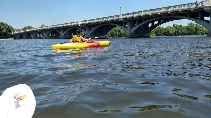
It was a cool experience paddling under the Ferry Street Bridge—it’s very graceful looking when seen from the water, with its many arches.
Exiting at Mississippi Point Park
You can’t miss the boat launch at Mississippi Point Park. It’s on the Champlin side of the river, it’s wide open and easy to approach. You may have to wait your turn if it’s busy, but it’s just a short jaunt up to the parking lot from the cement launch.
Another exit option in the vicinity is on the Anoka side of the river, Peninsula Point Park, at the confluence of the Mississippi and the Rum River. The map shows a boat launch there, too, as well as parking.
A nice half-day trip. It took Shelby and I just under 3 hours, and we were taking our time.
You’ll like these, too…
- Paddling in Coon Rapids Dam Regional Park
- Gear Review: Advanced Elements’ “Sport” Inflatable Kayak
- EnjoySUP: Find Your Joy on the Water

- New Winter Gear: How Do These Perform? - November 29, 2023
- Paddle North: SUPs, Kayaks and More - November 20, 2023
- 2023 Holiday Gift Guide for Outdoor Lovers - November 10, 2023