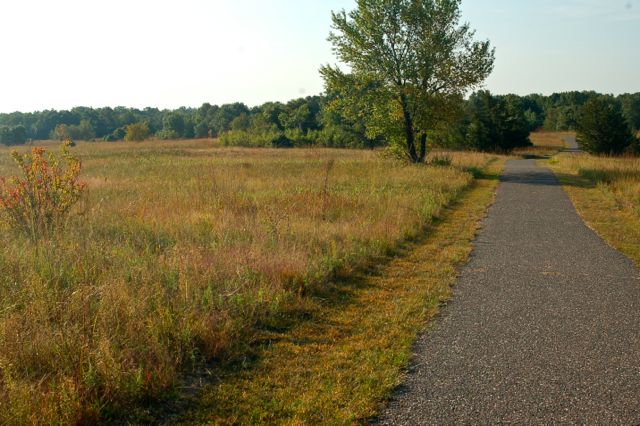
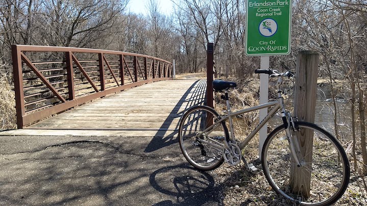
Anoka County has several regional paved bike trails, and 85 miles of bike trails within 12 of its regional and county parks.

The regional parks have parking fees so you’ll need either a daily or annual pass.
Of course biking is legal on any Minnesota roadway except interstate highways and some connecting freeways. But here we’ll focus on the off-the-roadway trails that offer:
- A more natural setting…
- No traffic to contend with, other then possibly an intersection to cross here and there.
Bunker-Chain of Lakes Regional Trail
Connecting several communities and other trails, Bunker Regional Trail is 11.5 miles long with another proposed 3 miles of paved trail coming. Access to East Anoka County, Central Anoka County and Rice Creek North Regional Trails. Details here.
Bunker Hills Regional Park (Coon Rapids)
There are several miles of multi-use paved trails in Bunker Hills Regional Park that are great for biking. You’ll share the trail with walkers, runners, and other folks on wheels (inline skaters, skateboarders, etc.) so be aware—especially around the many corners and over hills. Bikes aren’t allowed on the natural surface trails.
The Bunker trail system can be reached via neighboring trail systems, too: Central Anoka County Regional Trail (alongside or on roadways), Coon Creek Regional Trail (see below), Bunker Chain of Lakes Regional Trail (partly alongside or on roadways).
Bunker Hills Campground has direct access to the bike trail system if you want to explore all the trails over a weekend or few days. Here’s the Bunker map.
Read: Biking in Bunker Hills Regional Park
Central Anoka County Regional Trail
This regional trail has 16 finished miles with another 10 proposed. It connects to several other trails including Rum River Regional Trail, East Anoka County Regional Trail and Bunker-Chain of Lakes Regional Trail. Get the details here.
Coon Creek Regional Trail (Coon Rapids)
Most of this 6-mile paved multi-use trail follows Coon Creek and Sand Creek through woods and among neighborhoods. It connects Bunker Hills Regional Park to Coon Rapids Dam Regional Park. Here’s more information.

Read: Biking the Coon Creek Regional Trail
Coon Rapids Dam Regional Park (Coon Rapids)
The Mississippi River Regional Trail runs through Coon Rapids Dam from north to south. Bikers are also allowed on the wooded dirt/clay/gravel trail on the north side. Either way you’ll share the trail with hikers and runners (some with dogs).
This Park also connects to the Coon Creek Regional Trail (above) and the Rush Creek Regional Trail. The Rush Creek Trail crosses the Dam itself and heads west into Brooklyn Park. Here’s the map.
East Anoka County Regional Trail
Running through several Anoka County communities this regional trail is 27 miles long over several segments. It can be accessed in many different parks. Here’s more information.
Islands of Peace County Park (Fridley)
Islands of Peace is/has been receiving improvements lately, including new pavement on the short trail system. This park is very small, so great for biking with young children. Or it would make a lovely stop-over when you bike the Mississippi River Regional Trail. Here’s the Islands of Peace map.
Kordiak County Park (Columbia Heights)
Little Kordiak Park has a network of paved multi-use trails, most of which circle 2/3 of Highland Lake. The trails connect to neighborhood roads. Great for families with young children. Here’s the Kordiak map.
Lake George Regional Park (Oak Grove)
While there’s not a ton of bike trails within Lake George (it’s mostly known for its swimming beach and for boating), a paved trail connects to the Rum River Regional Trail. You can ride that northwest to Rum River North County Park.
Better yet, start at Rum River North on a hot summer day, and go for a swim before heading back! on Here’s the Lake George map.
Locke County Park (Fridley)
Rice Creek West Regional Trail runs through Locke County Park, which is a pocket of mature woods in the middle of urban Fridley. You can go off the paved trail onto the dirt connecting trails, too—just watch out for hikers. Here’s the Locke map.
Manomin County Park (Fridley)
Even smaller than Locke, Manomin County Park is at the crossroads of two rivers (where Rice Creek joins the Mississippi) and two Regional Trails—Mississippi River Regional Trail and Rice Creek West Regional Trail. A great stopping place for a picnic lunch! Here’s the Manomin map.
Mississippi River Regional Trail
Following alongside one of our national treasures—the Mississippi River—for many of its 20 miles, this trail provides access to several Anoka County points of interest. Another 4 miles are proposed as well. Accessing other trails and roadways, you could bike from the town of Anoka all the way into downtown Minneapolis if you so choose! Here’s more information.
Rice Creek Chain of Lakes Park Reserve (Centerville)
A great way to explore 5,500-acre Rice Creek Park Reserve is by bike. Besides biking within the reserve itself, you can join up with the Rice Creek North Regional Trail on the south side for more miles.
Rice Creek Campground is one of the best in the Twin Cities, so make it a weekend and take all the trails! Here’s the Rice Creek map.
Read: Biking at Rice Creek Park Reserve
Rice Creek North Regional Trail
Rice Creek North is in the southeast part of the county, and provides connections with East Anoka County Regional Trail and Bunker-Chain of Lakes Regional Trail. It connects with the trail system of Ramsey County, too. 6.5 of the proposed 8 miles are completed. Here’s more info for you.
Rice Creek West Regional Trail
This 4-mile trail connects Locke County Park with Manomin County Park in southern Anoka County. It’s length and beauty make it great for families, with plenty of picnic options along the way. Here are more details.
Riverfront Regional Park (Fridley)
The Mississippi River Regional Trail runs north-to-south through Riverfront Regional Park. It’s a lovely stop-over for a picnic lunch or break with its river-front location and mature trees. Here’s the Riverfront map.
Rum River Central Regional Park (Ramsey)
Rum River Central has beautiful paved multi-use trails through its heavily-wooded and quite hilly terrain. Every once in awhile you’ll be next to the Rum River or over some restored prairie. The horse trails aren’t for bikers, though. It’s not a long network, but very scenic. Here’s the Rum River Central map.
Rum River North County Park (St. Francis)
Rum River North has some paved trails within the Park, and connects to the Rum River Regional Trail on its south side. From here you can back southeast to Lake George Regional Park. On a hot day, you can go jump in the lake at the end of your ride! It also connects to the Sugar Hill Regional Trail. Here’s the Rum River North map.
Rum River Regional Trail
Rum River Regional Trail connects Lake George Regional Park to Rum River North County Park. It’s currently 9 miles long, with another proposed 11 miles coming. Here are more details.
Rum River South County Park (Anoka)
And finally, the southern most of the Rum River Parks, there are just a few paved trails running through Rum River South. Not enough for a workout, but great for youngsters just starting out on their biking career. Follow the trail down to the confluence of the Rum and the Mississippi Rivers. Here’s the Rum River South map.
Sugar Hills Regional Trail
Sugar Hills is a trail mostly in-the-works. Just 2 miles of its proposed 14 total miles are complete. It’s located in the northwest corner of the county. Get more details here.
Go to Anoka County’s Parks page for more details about all the regional and county parks.
Here’s a map with all of Anoka County’s bike trails.

Twin Cities Biking Guide
Published in 2020 and updated in 2023, our 54-page digital Biking Guide is the easiest, most convenient way to find bike trails in all seven counties of the Twin Cities metro area.
Fat Bike Trails
Anoka County now has a fat bike pilot program during our snow season. If you’re a fat biker (I mean, a biker who rides a fat bike!!), give it a try! Then let the Parks Office know what you think.
Mountain Bike Trails
Anoka County has no designated mountain bike trails. Honestly, Anoka County is pretty flat—it wouldn’t be very exciting 🙂
