St. Croix Falls, Wisconsin • Daily or annual park fee
Wisconsin’s Interstate Park has, hands-down, some of the best, most scenic hiking within an hour of the Twin Cities metro.
The St. Croix River, the forest, the many craggy rocks and boulders, the hills, the bluffs overlooking the river—all these contribute to make this park a winner for hikers.
I spent a glorious few hours there one day last October, while the yellow maples were in their peak fall color.
Here’s the trail map (courtesy of Wisconsin DNR) for reference as I bring you through the trails I hiked that day:
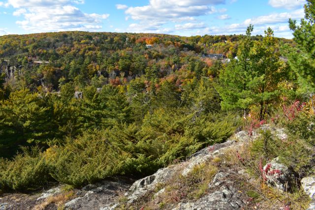
Eagle Peak Trail
Eagle Peak Trail, as its name makes obvious, takes you to Eagle Peak, the highest point in the park. Unfortunately, when the leaves are on the trees you can’t see much!
But the woods are still beautiful, and it was worth doing. I only took the section leading to the peak, not the longer section down to South Campground.
An advantage of this trail is it’s right next to South and Pines Group campgrounds. A very pretty area with huge mature pines, along with lots of maple, oak and others, too.
It’s short and would be a great hike for families with younger children. A few steps and some uphill climbs, but not bad
Horizon Rock Trail
Horizon and Potholes Trails can be accessed from the same parking lot, on the other end of the park from Eagle Point. It’s very close to North Campground.
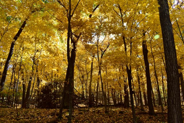
Horizon Rock Trail takes us away from the river and climbs into a gorgeous maple and oak forest. I felt like I was in Lothlórien, in Tolkien’s world—the golden wood.
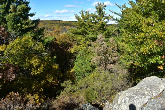
A steady but gentle climb takes us to some wonderful overlooks of the St. Croix River and river valley.
One very cool thing about this trail: It’s part of the very western-most end of Wisconsin’s 1,200-mile Ice Age National Scenic Trail.
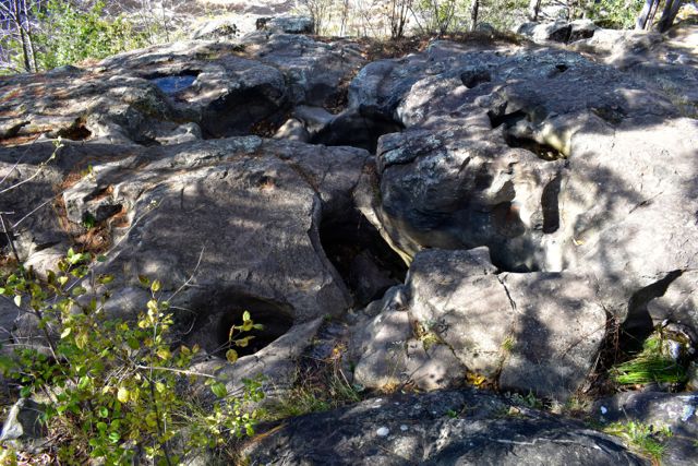
Potholes Trail
The Potholes Trail is the very end of the Ice Age Trail, and starts directly across the park road from Horizon Rock Trail.
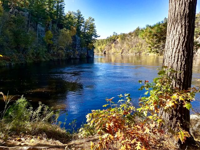
This short trail is super gorgeous because of its several overlooks of the St. Croix Dalles from the steep cliffs along the shore (dalles are river rapids between the walls of a gorge or canyon).
This particular view is, in my opinion, the most dramatic view of the St. Croix in the entire park:
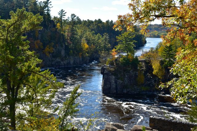
The potholes themselves are nothing to write home about, being very small compared to the ones on the Minnesota side, just across the river. But hey, they’re potholes!
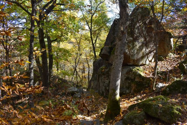
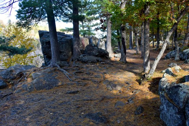
Summit Rock, Echo Canyon and River Bluff Trails
These are separate loops, but I highly recommend doing them as a unit as they’re the best trails in the park.
Steep climbs, big rocks and boulders everywhere, towering trees, high bluffs with stunning views of the St. Croix River, and downhills that bring you next to the shoreline.
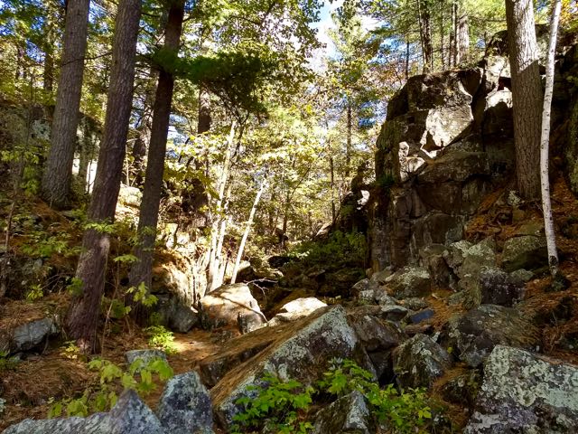
It’s one of those trails where I would often stop and just say, “Wow!”
Looking at the park map, this set of trail loops is between the river and Lake O’ the Dalles. It doesn’t matter where you start, it’s all beautiful.

In the fall when the leaves cover much of the forest floor it can be a bit tricky to see where the trail goes in some places. Sometimes you just have to give it your best guess. The woods aren’t thick, though, so if you end up off-trail it’s not hard to get back on.
If you have young children who love running off to explore, these trails will probably be stressful! Lots of cliff edges here that are high above the river.
The Bottom Line
If you love to hike and you haven’t visited Wisconsin’s Interstate Park, you need to go today!
Give yourself plenty of time because you’ll want to take time to explore. The trails are short enough that you can get several in during one trip.
I went on a perfect autumn weekday and saw a handful of others using the trails. I’m sure weekends are busier, and summer busier still.
But you don’t want to stay away from this local jewel…even if it is in Packer territory 🙂
What About the Winter?
Many of the trails are open during the winter months. The same map as above has a Winter Recreation Trail marked on it.
It’s multi-use for winter hikers and snowshoers (leashed dogs welcome). The Skyline Trail is groomed for cross country skiing, with only skiers allowed (intermediate difficulty).
It’s helpful that the map tells us the trail difficulty for winter use. Let’s us know what kind of workout to expect, and therefore how to dress.
How to Get There
Minnesota Highway 8 (which exits off 35 just north of Forest Lake) will take you all the way over there. If you’re on the east side of the Cities, make your way to Highway 95 and head north. It joins 8 for a little while, so just follow the signs to Wisconsin.
Once you cross the bridge, head up the hill and watch for the brown signs on the right which will direct you to the park.
Twin Cities Hiking & Trail Running Guide
Published in 2020 and updated in 2023, our 48-page digital Hiking & Trail Running Guide is the easiest way to find hiking and running trails in all seven counties of the Twin Cities metro area.
You’ll also like:
- Hiking in Minnesota’s Interstate Park
- Don’t Let a Little Snow Stop You: Get Outside in the Twin Cities
- Outdoors Beyond the Twin Cities

- New Winter Gear: How Do These Perform? - November 29, 2023
- Paddle North: SUPs, Kayaks and More - November 20, 2023
- 2023 Holiday Gift Guide for Outdoor Lovers - November 10, 2023