Vadnais Heights & Shoreview/Ramsey County • No vehicle permit • MN Ski Pass
Vadnais-Snail Lake Regional Park, in central Ramsey County, is a local gem with a few different groomed cross country ski trail systems in the winter.
These trails are ideal for beginning and intermediate classic and skate skiers as long as you have your own gear. No rentals are available.
Ramsey County works with the Minnesota DNR for trail grooming, so you’ll need the Minnesota Ski Pass for the groomed trails in the park. There’s nowhere to buy one on-site, so have yours before you head over.
FREE: “Best Ski Trails in the Twin Cities” download
The Vadnais Lake Ski Trails
This morning was my first time at the Vadnais Lake Trails. I was going from the old map, which only shows the trails around Sucker Lake, and on the north and east sides of Vadnais Lake.
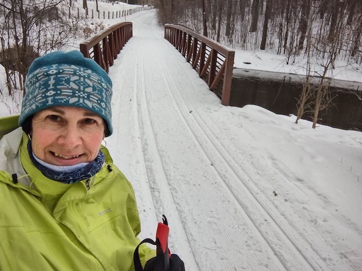
But when I got there, I realized (after I started skiing down the causeway between the two Vadnais Lakes) that there are two different trails there. The green trail in the map below starts from the east side of the parking lot while the yellow trail begins at the south end of the parking lot.
I decided to take on both of them right away:

I’m not sure on my total distance this morning, but I was skiing for just over an hour-and-a-half doing the yellow and green trails, out-and-back. That included a few pauses for pictures.
What’s to Love about the Vadnais-Snail Lake Ski Trails
I found these trails to be extremely scenic! My first one, the yellow trail on the map above, is marked as a multi-use trail on the new map. But there are definite tracks groomed, so classic skiing was easy.
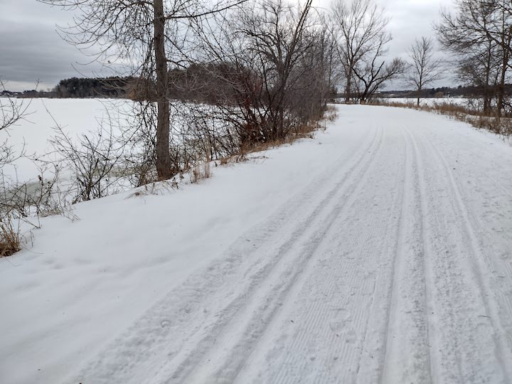
The yellow trail is very flat, which is OK for awhile. There were plenty of turns along the way which help make it a little more interesting.
I loved skiing with (frozen) water on both sides of me. I don’t know if I’ve ever done that before. It felt like a causeway. It must be just beautiful in the summer!
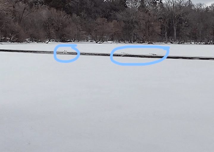
As soon as I got on the trail two pairs of swans flew by and landed in the open water (part of East Vadnais Lake is aerated during the winter). I also saw an eagle later on.
What a treat!
I only had my phone’s camera, so this photo isn’t any good, but you can tell they’re swans, I think!
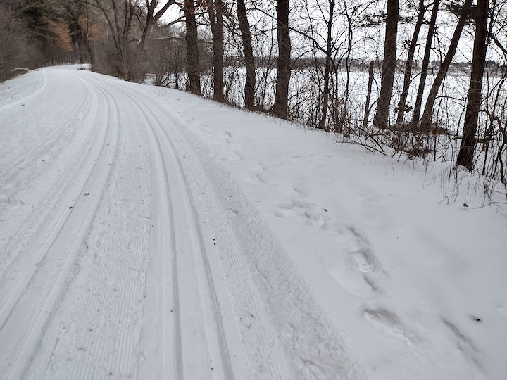
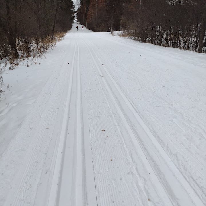
The green-dotted trail on the above map is much more interesting than the yellow one as far as skiing itself. It’s got several gradual slopes (I can’t really call them hills!) both up and down, several turns, and mature trees of many varieties all along the way on both sides.
The trail sticks close enough to the shoreline that the lake is almost always in view, even with the trees.
Anything Not to Love?
Because this regional park combines a few different lakes and areas together, and because it’s surrounded by county roads, highways and neighborhoods, the trail systems aren’t completely connected.
You can see what I mean by looking at the new winter map of the whole park.
That isn’t necessarily a problem unless you’re one that wants to ski for a couple of hours at a time. I had plenty of skiing, personally, by combining the two possibilities from my parking spot on the north end of Vadnais Lake.
There’s some traffic noise from Hwy 694, especially on the yellow trail between the two lakes. I didn’t notice it nearly as much on the trail on the east side. There’s also a railway close by, so that could dampen the nature feel at times, too.
The new map (published in 2021) is really great—except it doesn’t label the trails for difficulty or distance. Both of which are usually necessary! An interesting and unfortunate oversight.
Here’s what I can tell you from the old maps and from some personal experience:
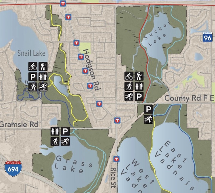
The yellow trails are Beginner. The dark blue trail south of Snail Lake is more Intermediate. The trail around Sucker Lake is Beginner on the west side and Intermediate on the right side (per an older map). The light blue trail by Grass Lake is Beginner (per an older map).
If I remember correctly (it’s been a few years since I’ve been on the Snail Lake trails) the trail systems between Snail and Grass Lakes connect via a tunnel underneath Gramsie Road.
There are some discrepancies between the new winter map and the signage at the trails—at least at the Vadnais Lake trail. The map labels some trails as ski-only, while the signage at the trails themselves state that hikers and snowshoers are also welcome, just please stay off the tracks.
So, skate skiers, there’s plenty of foot traffic on the skate deck.
What Else is at Vadnais-Snail Lake Regional Park
Both winter hiking and snowshoeing are allowed on the trails as long as you stay off the classic ski tracks.
I saw lots of snowshoe trails here and there off the groomed ski trail. They aren’t marked on the map, just some locals blazing their own trails. Makes me want to go back there with my snowshoes!
In the non-winter months there are five miles of paved, multi-use trails for hiking and biking. Again, not all of these are connected, but it’s easier to connect on a bike than on skis!
There’s a canoe launch on Snail Lake near the beautiful swimming beach to take a canoe, kayak or paddle board. There are no rentals on-site so you’ll need your own boat(s).
How to Get There
How to get there depends which parking lot/trailhead you’re after. Today, I parked in the lot on the south side of County F, just east of Rice Street. (I Googled “Vadnais Regional Park”)
The entire park “spread” is between Highway 96 and 694, and just to the east of Victoria/Hwy 52. You can go by the park map to find the street for your trailhead, either Snail Lake Blvd, Gramsie Rd or County F.
You’ll like these, too…
- Skiing and Snowshoeing in Ramsey County
- Cross Country Skiing in Fort Snelling State Park
- Cross Country Skiing at Chomonix Golf Course

- New Winter Gear: How Do These Perform? - November 29, 2023
- Paddle North: SUPs, Kayaks and More - November 20, 2023
- 2023 Holiday Gift Guide for Outdoor Lovers - November 10, 2023